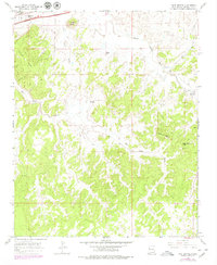
1963 Map of Twin Buttes
USGS Topo · Published 1980About this map
Torrivio Mesa and the surrounding high desert terrain dominate this landscape in McKinley County, where the dry drainage networks of Twin Buttes Wash and Salt Water Wash carve through the plateau. In the northwest corner, the development of Williams Acres and a nearby Trailer Park show the mid-century residential expansion near the transportation corridor of the At&Sf railroad and the Puerco River.
Find a feature on this map
19 named features on this map. Tap any name to fly to it.
Don’t see what you’re looking for? This feature index may not catch every label — zoom into the map to look around manually.
Map Details
Editions of this 1963 Twin Buttes Map
2 editions found
Other maps of this area

1886 · Wingate
USGS Topo · 1:250,000

1892 · Wingate
USGS Topo · 1:250,000

1954 · Gallup
USGS Topo · 1:250,000

1958 · Gallup
USGS Topo · 1:250,000

1959 · Gallup
USGS Topo · 1:250,000

1962 · Gallup
USGS Topo · 1:250,000

1963 · Twin Buttes
USGS Topo · 1:24,000

1963 · Gallup West
USGS Topo · 1:24,000

1963 · Manuelito
USGS Topo · 1:24,000

1963 · Jones Ranch School
USGS Topo · 1:24,000
Featured Places
- Gallup, NM
- Eastern Navajo Agency, NM
- Red Rock, Eastern Navajo Agency
- Williams Acres, NM
- McKinley County, NM