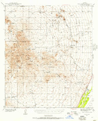
1939 Map of Twin Buttes
USGS Topo · Published 1957About this map
The Sierrita Mountains dominate this landscape south of Tucson, showing a region defined by cattle ranching and early mining at the end of the 1930s. Settled outposts like Pino Blanco Ranch and Batamote Ranch are scattered throughout the desert foothills, while the Santa Cruz River valley provides a corridor for transport and larger holdings like Canoa Ranch. The Southern Pacific railroad parallels the river through Canoa, marking the primary artery for the local economy. In the northern reaches, the San Xavier mission and nearby Mineral Hill reveal the complex history of religious and extractive development. This survey documents a transitional era where traditional ranching life, centered around features like McGee Sch, coexisted with industrial interests at the Twin Buttes settlement.
Find a feature on this map
40 named features on this map. Tap any name to fly to it.
Don’t see what you’re looking for? This feature index may not catch every label — zoom into the map to look around manually.
Map Details
Editions of this 1939 Twin Buttes Map
2 editions found

Other maps of this area

1904 · Patagonia
USGS Topo · 1:125,000

1904 · Tucson
USGS Topo · 1:125,000

1905 · Patagonia
USGS Topo · 1:125,000

1905 · Tucson
USGS Topo · 1:125,000

1920 · Arivaca
USGS Topo · 1:125,000

1922 · Agus Caliente
USGS Topo · 1:62,500

1925 · Samaniego Peak
USGS Topo · 1:62,500

1925 · San Xavier
USGS Topo · 1:62,500

1926 · Helvetia
USGS Topo · 1:62,500

1934 · Tucson Mountains
USGS Topo · 1:125,000