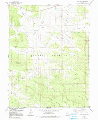
1983 Map of Twin Knolls
USGS Topo · Published 1991About this map
Sinbad Country defines the landscape of this 1980s Emery County survey, characterized by its complex network of named draws and flats. The terrain is marked by significant vertical features such as Block Mountain and Lone Man Butte, while the Twin Knolls stand as a central landmark. Water management in this arid environment is evident through several named catchments, including The Big Pond, State Pond, and the Woodpile Pond, alongside cattle-ranching indicators like Georges Draw Well and Lone Parson Hole. Early transport and ranching names are preserved in features like Earls Road and the Reid Neilson Draw. The presence of several prospects suggests historical mineral exploration in the vicinity of Ernie Canyon. This map provides a detailed view of the regional topography before modern changes, documenting the specific locations of Crawford Holes and Charley Holes within the high desert flats.
Find a feature on this map
24 named features on this map. Tap any name to fly to it.
Don’t see what you’re looking for? This feature index may not catch every label — zoom into the map to look around manually.
Map Details
Editions of this 1983 Twin Knolls Map
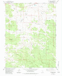
2 editions found
Other maps of this area

1885 · San Rafael
USGS Topo · 1:250,000

1952 · Wild Horse
USGS Topo · 1:62,500

1952 · San Rafael Knob
USGS Topo · 1:62,500

1953 · Stinking Spring Creek 2 SE
USGS Topo · 1:24,000

1953 · Temple Mtn
USGS Topo · 1:62,500

1954 · Stinking Spring Creek 1 SE
USGS Topo · 1:24,000

1954 · Stinking Spring Creek 1 NW
USGS Topo · 1:24,000

1954 · Stinking Spring Creek 4 NE
USGS Topo · 1:24,000

1954 · Stinking Spring Creek 4 NW
USGS Topo · 1:24,000

1954 · Stinking Spring Creek 1 NE
USGS Topo · 1:24,000