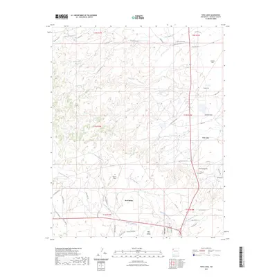
2023 Map of Twin Lakes
USGS Topo · Published 2023About this map
Twin Lakes and Rock Springs anchor this high-desert landscape in McKinley County, where the terrain is defined by a series of prominent mesas and deep drainage washes. The settlement pattern reflects a modern rural New Mexico network, centered around the junction near Yah-ta-hey. The topography is marked by distinctively named landmarks such as Umbrella Butte, Gossip Hill, and the elevated Banana Ridge.
Find a feature on this map
54 named features on this map. Tap any name to fly to it.
Don’t see what you’re looking for? This feature index may not catch every label — zoom into the map to look around manually.
Map Details
Editions of this 2023 Twin Lakes Map
This is the sole edition of this map. No revisions or reprints were ever made.
Other maps of this area

1886 · Wingate
USGS Topo · 1:250,000

1892 · Wingate
USGS Topo · 1:250,000

1954 · Gallup
USGS Topo · 1:250,000

1955 · Tohatchi
USGS Topo · 1:62,500

1958 · Gallup
USGS Topo · 1:250,000

1959 · Gallup
USGS Topo · 1:250,000

1962 · Gallup
USGS Topo · 1:250,000

1963 · Twin Lakes
USGS Topo · 1:24,000

1963 · Big Rock Hill
USGS Topo · 1:24,000

1963 · Gallup West
USGS Topo · 1:24,000
Featured Places
- Fort Defiance Agency
- Eastern Navajo Agency, NM
- Twin Lakes, Fort Defiance Agency
- Yah-ta-hey, NM
- Tohlakai, Eastern Navajo Agency