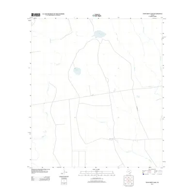
2013 Map of Twin Mott Lake
USGS Topo · Published 2013About this map
Twin Mott Lake and the surrounding coastal plains of Aransas County define this quiet landscape as it appeared in the early 21st century. The area is characterized by a network of intermittent waterways and small bodies of water, including Zapata Lake and Thomas Lake. This territory remains largely rural, with the settlement at Cavasso Pens and the transit corridor of FM-774 providing the primary points of human activity. The drainage patterns are particularly intricate, with Copano Cr and Salt Creek winding through the terrain toward the Texas coast. Local connectivity is maintained through rural routes like 3 Mi Winsor Rd, which cuts through the open spaces between Cavasso Cr and Willow Creek.
Find a feature on this map
12 named features on this map. Tap any name to fly to it.
Don’t see what you’re looking for? This feature index may not catch every label — zoom into the map to look around manually.
Map Details
Editions of this 2013 Twin Mott Lake Map
This is the sole edition of this map. No revisions or reprints were ever made.
Other maps of this area

1952 · St. Charles Bay
USGS Topo · 1:24,000

1952 · Tivoli
USGS Topo · 1:24,000

1952 · Tivoli SW
USGS Topo · 1:24,000

1953 · Beeville
USGS Topo · 1:250,000

1954 · Rockport
USGS Topo · 1:62,500

1954 · Vidaurri
USGS Topo · 1:62,500

1956 · Beeville
USGS Topo · 1:250,000

1960 · Beeville
USGS Topo · 1:250,000

1978 · Vidaurri
USGS Topo · 1:24,000
1978 · Twin Mott Lake
USGS Topo · 1:24,000