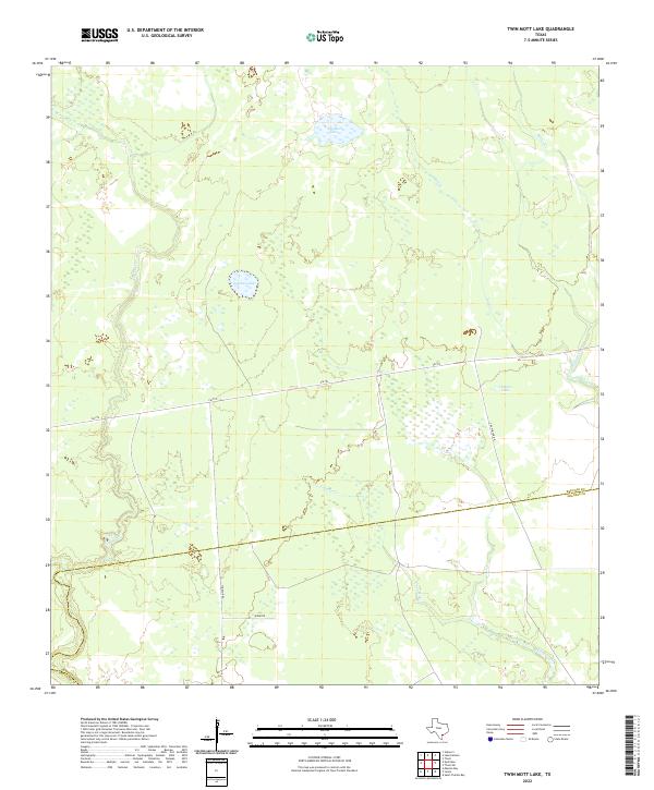
2022 Map of Twin Mott Lake
USGS Topo · Published 2022About this map
Windsor and the surrounding coastal plains of Refugio and Aransas counties are defined by a complex network of wetlands and tidal creeks. This landscape is dominated by the sprawling drainage of Copano Cr and Cavasso Cr, which feed into the larger bay systems just beyond the map's edge. The presence of several distinct interior water bodies, such as Twin Mott Lake, Zapata Lake, and Thomas Lake, suggests a low-lying terrain where freshwater and brackish influences meet.
Find a feature on this map
13 named features on this map. Tap any name to fly to it.
Don’t see what you’re looking for? This feature index may not catch every label — zoom into the map to look around manually.
Map Details
Editions of this 2022 Twin Mott Lake Map
This is the sole edition of this map. No revisions or reprints were ever made.
Other maps of this area

1952 · St. Charles Bay
USGS Topo · 1:24,000

1952 · Tivoli
USGS Topo · 1:24,000

1952 · Tivoli SW
USGS Topo · 1:24,000

1953 · Beeville
USGS Topo · 1:250,000

1954 · Rockport
USGS Topo · 1:62,500

1954 · Vidaurri
USGS Topo · 1:62,500

1956 · Beeville
USGS Topo · 1:250,000

1960 · Beeville
USGS Topo · 1:250,000

1978 · Vidaurri
USGS Topo · 1:24,000
1978 · Twin Mott Lake
USGS Topo · 1:24,000