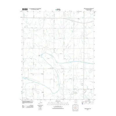
2012 Map of Twin Mounds
USGS Topo · Published 2012About this map
The Cimarron River winds through this central Oklahoma landscape, cutting a wide path between the rural settlements of Twin Mounds and Amabel. This 2012 survey illustrates the transition from the river bottomlands to the uplands, marked by significant local landmarks like Hog Hollow and several prominent drainage systems including Council Cr and Short Cr. For those researching local family histories, the map identifies a high concentration of burial grounds, including the Ingall Cem in the northwest and the clustered New Zion Cem and Fairlawn Cem to the southeast. The area around Dunkin Bridge and Dunkin Cem shows the intersection of the river and the established section-line road grid, while the community of Gano sits near the eastern edge. Cushing Lake and the various creeks feeding the Cimarron define the hydrology of this Payne County region.
Find a feature on this map
67 named features on this map. Tap any name to fly to it.
Don’t see what you’re looking for? This feature index may not catch every label — zoom into the map to look around manually.
Map Details
Editions of this 2012 Twin Mounds Map
This is the sole edition of this map. No revisions or reprints were ever made.
Other maps of this area

1908 · Agra
USGS Topo · 1:62,500

1929 · Yale
USGS Topo · 1:62,500

1929 · Ripley
USGS Topo · 1:62,500

1931 · Drumright
USGS Topo · 1:62,500

1932 · Yale
USGS Topo · 1:62,500

1932 · Ripley
USGS Topo · 1:62,500

1954 · Oklahoma City
USGS Topo · 1:250,000

1955 · Enid
USGS Topo · 1:250,000

1957 · Oklahoma City
USGS Topo · 1:250,000

1958 · Enid
USGS Topo · 1:250,000