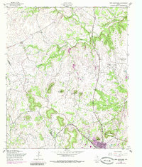
1958 Map of Twin Mountains
USGS Topo · Published 1985About this map
The hills and canyons of Central Texas define this mid-century survey, centered on the expanding settlement of Copperas Cove and the western edge of the Fort Hood Military Reservation. The landscape is dominated by distinctive mesas and peaks including Herzog Mountain, Anderson Mountain, and the namesake Twin Mountains. Local transit and economy are anchored by the Gulf Colorado and Santa Fe railroad, which skirts the southern edge of the quadrangle. Rural life is evidenced by the presence of Topsey and several family-named landmarks like Beecham Gap. Genealogists will find significant value in the detailed mapping of local burial sites and spiritual centers, such as Immanuel Ch, Immanuel Cem, and Botcher Cem. The drainages of Bennett Creek and House Creek carve through the limestone terrain, illustrating the natural water network before modern suburban development transformed the periphery of the military installation.
Find a feature on this map
38 named features on this map. Tap any name to fly to it.
Don’t see what you’re looking for? This feature index may not catch every label — zoom into the map to look around manually.
Map Details
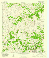
Editions of this 1958 Twin Mountains Map
2 editions found
Other maps of this area

1887 · Lampasas
USGS Topo · 1:125,000

1894 · Lampasas
USGS Topo · 1:125,000

1894 · Gatesville
USGS Topo · 1:125,000

1947 · Fort Hood
USGS Topo · 1:62,500

1947 · Fort Hood
USGS Topo · 1:24,000

1947 · Purmela
USGS Topo · 1:62,500

1947 · McMillan Mountains
USGS Topo · 1:24,000

1947 · Pidcoke
USGS Topo · 1:24,000

1947 · Shell Mountains
USGS Topo · 1:24,000

1947 · Twin Moutains
USGS Topo · 1:24,000