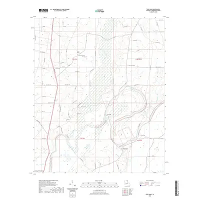
2020 Map of Twin Oaks
USGS Topo · Published 2020About this map
Bayou Bartholomew winds through this section of Morehouse Parish, defining a landscape shaped by intricate drainage systems and low-lying wetlands. The area around Twin Oaks is characterized by its numerous bayous and brakes, such as Harrell Brake and Pratt Brake, which illustrate the hydraulic complexity of the Louisiana interior. These natural features are complemented by an extensive network of rural roads and trails, including Chitlin Trl and Cora Bluff Rd, which provide access to family-named landmarks and historical sites.
Find a feature on this map
71 named features on this map. Tap any name to fly to it.
Don’t see what you’re looking for? This feature index may not catch every label — zoom into the map to look around manually.
Map Details
Editions of this 2020 Twin Oaks Map
This is the sole edition of this map. No revisions or reprints were ever made.
Other maps of this area

1935 · Wilmot
USGS Topo · 1:62,500

1935 · Naff
USGS Topo · 1:62,500

1935 · Bonita
USGS Topo · 1:62,500

1953 · Greenwood
USGS Topo · 1:250,000

1955 · Jackson
USGS Topo · 1:250,000

1956 · Greenwood
USGS Topo · 1:250,000

1956 · Bastrop
USGS Topo · 1:62,500

1958 · Bonita
USGS Topo · 1:62,500

1960 · Wilmot
USGS Topo · 1:62,500
1960 · Wilmot SW
USGS Topo · 1:24,000