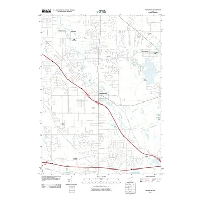
2010 Map of Twinsburg
USGS Topo · Published 2010About this map
Twinsburg serves as the central hub of this northern Ohio landscape, where suburban expansion meets the winding course of Tinkers Creek. By 2010, the area shows a complex network of residential developments such as Applecreek Village and industrial corridors like Enterprise Pkwy, illustrating the region's transition from its rural roots. To the north, the village of Glenwillow and the rail-oriented Falls Junction highlight the historical infrastructure that once anchored local industry. Significant water features including Aurora Pond, Geauga Lake, and the man-made Lake Forest characterize the eastern and southern reaches of the quadrangle. Local history and genealogy interest is found in the sprawling Crown Hill Cemetery and smaller Markillie Cemetery, while recreational spaces like the Glen Eagle Golf Course and Camp Bates provide a look at the community's modern land use and social infrastructure.
Find a feature on this map
60 named features on this map. Tap any name to fly to it.
Don’t see what you’re looking for? This feature index may not catch every label — zoom into the map to look around manually.
Map Details
Editions of this 2010 Twinsburg Map
This is the sole edition of this map. No revisions or reprints were ever made.
Other maps of this area

1903 · Cleveland
USGS Topo · 1:62,500

1903 · Akron
USGS Topo · 1:62,500

1905 · Akron
USGS Topo · 1:62,500

1906 · Kent
USGS Topo · 1:62,500

1906 · Chagrin Falls
USGS Topo · 1:62,500

1908 · Chagrin Falls
USGS Topo · 1:62,500

1950 · Cleveland
USGS Topo · 1:250,000

1953 · South Russell
USGS Topo · 1:24,000

1953 · Aurora
USGS Topo · 1:24,000

1953 · Chagrin Falls
USGS Topo · 1:24,000