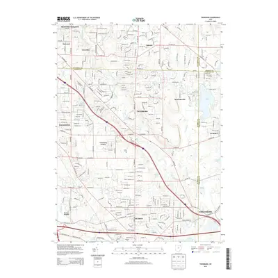
2013 Map of Twinsburg
USGS Topo · Published 2013About this map
Twinsburg and Solon define the core of this suburban landscape at the intersection of Cuyahoga, Summit, Portage, and Geauga counties. The transition from industrial development to residential expansion is evident in the corridors surrounding Solon Industrial Pkwy and Summit Commerce Park. Despite this growth, significant natural and historical markers remain preserved. Tinkers Creek and Pond Brook weave through the terrain, feeding into Aurora Pond and Waterfalls Lake. For those tracing local heritage, several significant burial grounds are documented, including Locust Grove Cem and Crown Hill Cem. The map illustrates the sophisticated road network connecting established settlements like Hudson and Macedonia with newer residential clusters such as Twinsburg Heights and Reminderville. The geography is further marked by the courses of Brandywine Cr and the presence of Darrow Park, showcasing a region balancing commerce with its natural hydrology.
Find a feature on this map
47 named features on this map. Tap any name to fly to it.
Don’t see what you’re looking for? This feature index may not catch every label — zoom into the map to look around manually.
Map Details
Editions of this 2013 Twinsburg Map
This is the sole edition of this map. No revisions or reprints were ever made.
Other maps of this area

1903 · Cleveland
USGS Topo · 1:62,500

1903 · Akron
USGS Topo · 1:62,500

1905 · Akron
USGS Topo · 1:62,500

1906 · Kent
USGS Topo · 1:62,500

1906 · Chagrin Falls
USGS Topo · 1:62,500

1908 · Chagrin Falls
USGS Topo · 1:62,500

1950 · Cleveland
USGS Topo · 1:250,000

1953 · South Russell
USGS Topo · 1:24,000

1953 · Aurora
USGS Topo · 1:24,000

1953 · Chagrin Falls
USGS Topo · 1:24,000