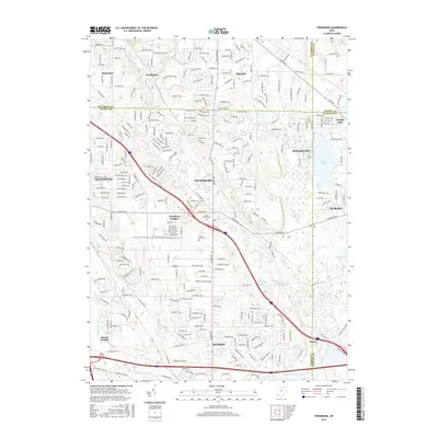
2016 Map of Twinsburg
USGS Topo · Published 2016About this map
Tinkers Creek and its various tributaries carve through this landscape at the intersection of Cuyahoga, Summit, Portage, and Geauga counties. The sprawling suburban development of Solon, Twinsburg, and Hudson is visible here, illustrating the mid-2010s infrastructure of Northeast Ohio. This area, known for its glacial topography, features numerous small bodies of water such as Aurora Pond, Waterfall Lake, and the well-known Geauga Lake on the border with Reminderville. The map documents established local communities and landmarks like Twinsburg Heights and Boston Heights, alongside the extensive Crown Hill Cem. Major transportation corridors, including I-480, Oh-82, and I-80, intersect the terrain, reflecting the region's role as a vital transit hub between major metropolitan centers.
Find a feature on this map
34 named features on this map. Tap any name to fly to it.
Don’t see what you’re looking for? This feature index may not catch every label — zoom into the map to look around manually.
Map Details
Editions of this 2016 Twinsburg Map
This is the sole edition of this map. No revisions or reprints were ever made.
Other maps of this area

1903 · Cleveland
USGS Topo · 1:62,500

1903 · Akron
USGS Topo · 1:62,500

1905 · Akron
USGS Topo · 1:62,500

1906 · Kent
USGS Topo · 1:62,500

1906 · Chagrin Falls
USGS Topo · 1:62,500

1908 · Chagrin Falls
USGS Topo · 1:62,500

1950 · Cleveland
USGS Topo · 1:250,000

1953 · South Russell
USGS Topo · 1:24,000

1953 · Aurora
USGS Topo · 1:24,000

1953 · Chagrin Falls
USGS Topo · 1:24,000