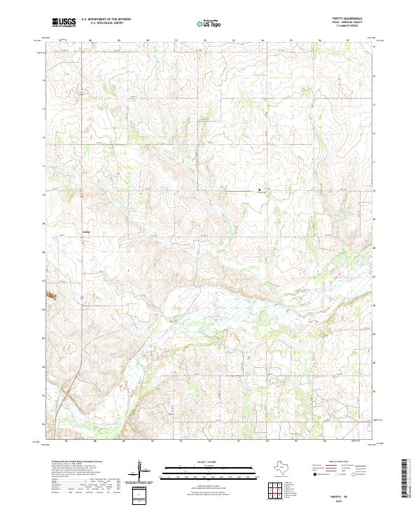
2022 Map of Twitty
USGS Topo · Published 2022About this map
The N Fork Red River creates a wide, braided alluvial corridor across this Panhandle landscape, where the ephemeral waters of Bronco Cr and Roundup Cr drain toward the river basin. The small settlement of Twitty sits at the intersection of local routes, representing the enduring rural character of Wheeler County. North of the river, the Center Cem serves as a silent landmark for the surrounding ranching and farming community. The landscape is defined by a dense network of section-line roads, including FM 592 and FM 1906, which overlay the natural topography of the river's tributaries. This modern survey shows a region where human settlement is closely tied to the watercourses and the established grid of the Texas Panhandle.
Find a feature on this map
26 named features on this map. Tap any name to fly to it.
Don’t see what you’re looking for? This feature index may not catch every label — zoom into the map to look around manually.
Map Details
Editions of this 2022 Twitty Map
This is the sole edition of this map. No revisions or reprints were ever made.
Other maps of this area

1954 · Amarillo
USGS Topo · 1:250,000

1958 · Amarillo
USGS Topo · 1:250,000

1962 · Twitty
USGS Topo · 1:24,000

1962 · Kelton SE
USGS Topo · 1:24,000

1962 · Wheeler
USGS Topo · 1:24,000

1962 · Wheeler SE
USGS Topo · 1:24,000

1963 · Kelton
USGS Topo · 1:24,000

1963 · Kelton NW
USGS Topo · 1:24,000

1963 · Fulller
USGS Topo · 1:24,000

1963 · Shamrock East
USGS Topo · 1:24,000