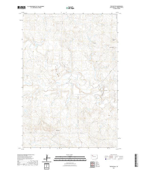
2021 Map of Two Buttes
USGS Topo · Published 2021About this map
Isolated summits rise above the Perkins County landscape in this 2021 survey of the Two Buttes area. The namesake Two Buttes and nearby Johnny Butte stand as prominent landmarks in a terrain carved by the complex drainage systems of Rabbit Cr and Antelope Cr. The geography is defined by these seasonal watercourses, including the North and South forks of N Reinoehl Cr and S Reinoehl Cr, which dictate the winding paths of rural connectors like Chance Rd and Rabbit Creek Rd.
Find a feature on this map
21 named features on this map. Tap any name to fly to it.
Don’t see what you’re looking for? This feature index may not catch every label — zoom into the map to look around manually.
Map Details
Editions of this 2021 Two Buttes Map
This is the sole edition of this map. No revisions or reprints were ever made.
Other maps of this area

1951 · Deep Creek NW
USGS Topo · 1:24,000

1951 · Bixby
USGS Topo · 1:24,000

1952 · Deep Creek NE
USGS Topo · 1:24,000

1954 · Lemmon
USGS Topo · 1:250,000

1957 · Lemmon
USGS Topo · 1:250,000

1983 · Rabbit Butte
USGS Topo · 1:24,000

1983 · Sunrise Butte
USGS Topo · 1:24,000

1983 · Date NE
USGS Topo · 1:24,000

1983 · Owen Lake
USGS Topo · 1:24,000
1983 · Chance
USGS Topo · 1:24,000