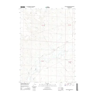
2015 Map of Two Buttes Reservoir
USGS Topo · Published 2015About this map
New Fork River winds through the high desert floor of Sublette County, creating a riparian corridor that stands in sharp contrast to the surrounding arid terrain. Near the center of this landscape, Mack Island sits at the confluence of several small watercourses, reflecting the intricate drainage patterns of the upper Green River Basin. To the north, the elevated plateau of The Mesa dominates the skyline, while drainage features like Lovatt Draw and Sand Springs Draw define the local topography.
Find a feature on this map
17 named features on this map. Tap any name to fly to it.
Don’t see what you’re looking for? This feature index may not catch every label — zoom into the map to look around manually.
Map Details
Editions of this 2015 Two Buttes Reservoir Map
This is the sole edition of this map. No revisions or reprints were ever made.
Other maps of this area

1955 · Lander
USGS Topo · 1:250,000

1958 · Lander
USGS Topo · 1:250,000

1961 · Lander
USGS Topo · 1:250,000

1964 · Two Buttes Reservoir
USGS Topo · 1:24,000

1964 · Ross Butte
USGS Topo · 1:24,000

1964 · Boulder Lake
USGS Topo · 1:24,000
1964 · Olsen Ranch
USGS Topo · 1:24,000

1964 · Mount Airy
USGS Topo · 1:24,000

1964 · Mesa Spring
USGS Topo · 1:24,000

1964 · Boulder
USGS Topo · 1:24,000