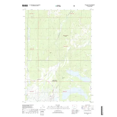
2017 Map of Two Ocean Lake
USGS Topo · Published 2017About this map
Two Ocean Lake and Emma Matilda Lake anchor the southern reaches of this landscape within Grand Teton National Park and the Teton National Forest. The map documents a complex drainage system where Pilgrim Cr and its tributaries, including the E Fork Pilgrim Cr and W Pilgrim, flow through the high country. To the west, Arizona Lake and the smaller Cygnet Pond sit near the base of the mountains, while landmarks like Grand View Point and Pilgrim Mtn offer significant elevation markers. The presence of Lunch Tree Hill and Christian Pond near the North Park Road corridor highlights the developed access points for researchers and visitors. The map illustrates the transition from the forested slopes of the Teton National Forest into the protected valley floor, showing the network of secondary routes like Pilgrim Creek Road and Two Ocean Lake Road that connect these remote water bodies.
Find a feature on this map
30 named features on this map. Tap any name to fly to it.
Don’t see what you’re looking for? This feature index may not catch every label — zoom into the map to look around manually.
Map Details
Editions of this 2017 Two Ocean Lake Map
This is the sole edition of this map. No revisions or reprints were ever made.
Other maps of this area

1885 · Lake
USGS Topo · 1:125,000

1886 · Shoshone
USGS Topo · 1:125,000

1888 · Shoshone
USGS Topo · 1:125,000

1895 · Shoshone
USGS Topo · 1:125,000

1895 · Lake
USGS Topo · 1:125,000

1896 · Lake
USGS Topo · 1:125,000

1899 · Grand Teton
USGS Topo · 1:125,000

1901 · Shoshone
USGS Topo · 1:125,000

1901 · Lake
USGS Topo · 1:125,000

1901 · Grand Teton
USGS Topo · 1:125,000