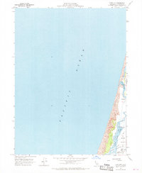
1959 Map of Tyee City
USGS Topo · Published 1968About this map
Mad River dominates the coastal geography of this Humboldt County region, winding through the alluvial plains of the Arcata Bottoms before meeting the Pacific Ocean. The landscape is a complex network of waterways, featuring Mud Slough, Liscom Slough, and Jackson Slough protected by a series of levees. These hydraulic engineering features reflect the era's focus on reclaiming and protecting low-lying coastal land for agricultural or industrial use.
Find a feature on this map
13 named features on this map. Tap any name to fly to it.
Don’t see what you’re looking for? This feature index may not catch every label — zoom into the map to look around manually.
Map Details
Editions of this 1959 Tyee City Map
3 editions found
Other maps of this area

1922 · Eureka
USGS Topo · 1:62,500

1933 · Eureka
USGS Topo · 1:48,000

1942 · Eureka
USGS Topo · 1:62,500

1945 · Trinidad
USGS Topo · 1:62,500

1949 · Eureka
USGS Topo · 1:250,000

1951 · Eureka
USGS Topo · 1:62,500
1952 · Trinidad
USGS Topo · 1:62,500
1952 · Arcata North
USGS Topo · 1:24,000
1958 · Eureka
USGS Topo · 1:24,000

1958 · Eureka
USGS Topo · 1:250,000