1991 Map of Tyler
USGS Topo · Published 1991About this map
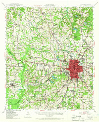
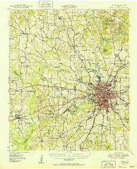
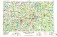
The sprawling Lake Palestine forms a central vertical spine through this East Texas landscape, created by the damming of the Neches River. Surrounding the water are dozens of rural crossroads and farming communities like Mixon, Blackjack, and Sinclair City, which illustrate the region's transition from early 20th-century agriculture to the more modern suburban and recreational patterns of the early 1990s. The dense concentration of urban development in Tyler and Athens contrasts with the protected woodlands of Tyler State Park and Purtis Creek State Park. Significant water features such as Kickapoo Creek and Mud Creek drain the undulating terrain, while smaller settlements like Ben Wheeler and Frankston anchor the road networks across five county lines, including Smith, Henderson, and Cherokee counties.
Find a feature on this map
106 named features on this map. Tap any name to fly to it.
Don’t see what you’re looking for? This feature index may not catch every label — zoom into the map to look around manually.
Map Details
Editions of this 1991 Tyler Map
This is the sole edition of this map. No revisions or reprints were ever made.
Historical Maps of Tyler Through Time
6 maps found