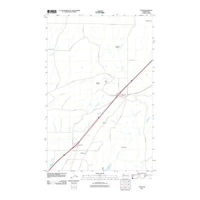
2011 Map of Tyler
USGS Topo · Published 2011About this map
Tyler and the neighboring settlement of Fishtrap anchor this 2011 survey of the high plateau in southwest Spokane County. The landscape is defined by the channeled scablands and vast open reaches of Malloy Prairie, punctuated by the deep incision of Hog Canyon and the waters of Hog Lake. This era shows a network of modern interstate travel intersecting with older transit routes like the W Old PSH 11 and Old State Hwy.
Find a feature on this map
39 named features on this map. Tap any name to fly to it.
Don’t see what you’re looking for? This feature index may not catch every label — zoom into the map to look around manually.
Map Details
Editions of this 2011 Tyler Map
This is the sole edition of this map. No revisions or reprints were ever made.
Other maps of this area

1943 · Medical Lake
USGS Topo · 1:62,500

1945 · Reardan
USGS Topo · 1:62,500

1953 · Reardan
USGS Topo · 1:62,500

1954 · Medical Lake
USGS Topo · 1:24,000

1954 · Medical Lake
USGS Topo · 1:62,500

1954 · Cheney
USGS Topo · 1:62,500

1954 · Sprague
USGS Topo · 1:62,500

1955 · Spokane
USGS Topo · 1:250,000

1958 · Spokane
USGS Topo · 1:250,000
1963 · Medical Lake
USGS Topo · 1:24,000