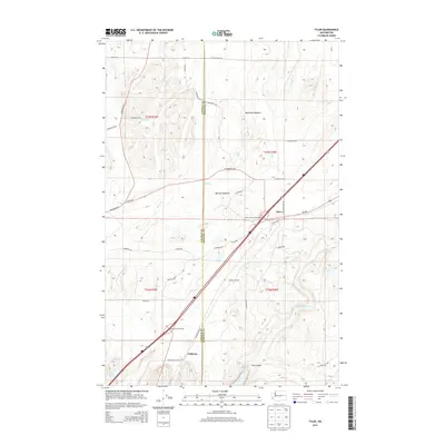
2014 Map of Tyler
USGS Topo · Published 2014About this map
The boundary between Lincoln and Spokane counties defines the central axis of this landscape, where the Channeled Scablands topography meets the agricultural plateaus of Eastern Washington. The community of Tyler sits at the eastern edge of the sheet, serving as a focal point near the Tyler-Cheney Interchange. To the southwest, the settlement of Fishtrap and its associated Fishtrap Interchange provide access to the rocky terrain surrounding Hog Canyon and the seasonal flows of Hog Canyon Cr.
Find a feature on this map
41 named features on this map. Tap any name to fly to it.
Don’t see what you’re looking for? This feature index may not catch every label — zoom into the map to look around manually.
Map Details
Editions of this 2014 Tyler Map
This is the sole edition of this map. No revisions or reprints were ever made.
Other maps of this area

1943 · Medical Lake
USGS Topo · 1:62,500

1945 · Reardan
USGS Topo · 1:62,500

1953 · Reardan
USGS Topo · 1:62,500

1954 · Medical Lake
USGS Topo · 1:24,000

1954 · Medical Lake
USGS Topo · 1:62,500

1954 · Cheney
USGS Topo · 1:62,500

1954 · Sprague
USGS Topo · 1:62,500

1955 · Spokane
USGS Topo · 1:250,000

1958 · Spokane
USGS Topo · 1:250,000
1963 · Medical Lake
USGS Topo · 1:24,000