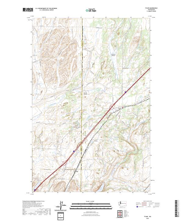
2023 Map of Tyler
USGS Topo · Published 2023About this map
Fishtrap and Tyler anchor this landscape along the Lincoln Co Spokane Co boundary, where the drainage of Rock Creek and Hog Canyon Creek shapes the geography. The map reveals a transition from wetland meadows like Moreland Meadow and Bennett Meadow to localized water bodies including Alderman Lake, Ames Lake, and the distinctly named Turtle Hole. A robust network of local roads, such as W Drumheller Rd and S Columbia Basin Hwy, connects these outlying settlements to the surrounding timber and grazing lands.
Find a feature on this map
44 named features on this map. Tap any name to fly to it.
Don’t see what you’re looking for? This feature index may not catch every label — zoom into the map to look around manually.
Map Details
Editions of this 2023 Tyler Map
This is the sole edition of this map. No revisions or reprints were ever made.
Other maps of this area

1943 · Medical Lake
USGS Topo · 1:62,500

1945 · Reardan
USGS Topo · 1:62,500

1953 · Reardan
USGS Topo · 1:62,500

1954 · Medical Lake
USGS Topo · 1:24,000

1954 · Medical Lake
USGS Topo · 1:62,500

1954 · Cheney
USGS Topo · 1:62,500

1954 · Sprague
USGS Topo · 1:62,500

1955 · Spokane
USGS Topo · 1:250,000

1958 · Spokane
USGS Topo · 1:250,000
1963 · Medical Lake
USGS Topo · 1:24,000