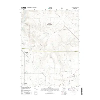
2016 Map of Tylersburg
USGS Topo · Published 2016About this map
Allegheny National Forest land dominates the northern portion of this area, where the terrain is deeply incised by the drainage basins of Little Coon Cr and Coon Creek. The boundary between Forest and Clarion Counties bisects the map, marking a transition from the protected forestlands to the more settled rural landscape of the south. This lower half is characterized by a network of crossroads communities and small hamlets, including Tylersburg, Leeper, and Crown, which are connected by Rte 66. The distribution of residential roads and small watercourses like Licking Cr and Toby Cr suggests a persistent pattern of agricultural and timber-related settlement. Distinctive local landmarks such as Tionesta Lake in the northwest corner and smaller junctions like Frills Corners and Golinza provide precise points for genealogical and geographical research in this part of Western Pennsylvania.
Find a feature on this map
58 named features on this map. Tap any name to fly to it.
Don’t see what you’re looking for? This feature index may not catch every label — zoom into the map to look around manually.
Map Details
Editions of this 2016 Tylersburg Map
This is the sole edition of this map. No revisions or reprints were ever made.
Other maps of this area

1918 · Loleta
USGS Topo · 1:62,500

1922 · Tionesta
USGS Topo · 1:62,500

1924 · Tionesta
USGS Topo · 1:62,500

1927 · Tidioute
USGS Topo · 1:48,000

1930 · Tidioute
USGS Topo · 1:62,500

1935 · Sheffield
USGS Topo · 1:48,000

1936 · Marienville
USGS Topo · 1:48,000

1941 · Sheffield
USGS Topo · 1:62,500

1941 · Marienville
USGS Topo · 1:62,500

1946 · Tionesta
USGS Topo · 1:62,500