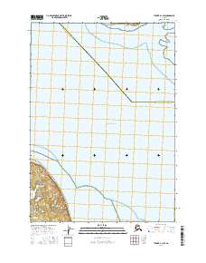
2016 Map of Tyonek A-1 SW
USGS Topo · Published 2016About this map
Point Possession anchors the southwestern portion of this map, marking a critical geographic junction where the mainland of the Kenai Peninsula meets the waters of the Pacific Ocean. This coastal landscape is defined by its transition from the tidal flats and salt marshes of the shoreline to the inland presence of Diamond Lake. The map illustrates a significant administrative boundary dividing the Anchorage Municipality and Kenai Peninsula Borough, which cuts diagonally across the marine waters. To the north, the southern tip of Fire Island is visible, highlighting the strategic maritime position of this area at the entrance to Upper Cook Inlet. The cartography emphasizes the interplay between these large-scale jurisdictional lines and the natural coastal features that have long shaped navigation and land use in this part of Alaska.
Find a feature on this map
8 named features on this map. Tap any name to fly to it.
Don’t see what you’re looking for? This feature index may not catch every label — zoom into the map to look around manually.
Map Details
Editions of this 2016 Tyonek A-1 SW Map
This is the sole edition of this map. No revisions or reprints were ever made.
Other maps of this area

1944 · Kenai
USGS Topo · 1:250,000

1949 · Tyonek
USGS Topo · 1:250,000

1950 · Kenai
USGS Topo · 1:250,000

1951 · Tyonek
USGS Topo · 1:250,000

1951 · Kenai D-1
USGS Topo · 1:63,360

1951 · Kenai D-2
USGS Topo · 1:63,360

1951 · Tyonek A-2
USGS Topo · 1:63,360

1951 · Tyonek A-1
USGS Topo · 1:63,360

1952 · Kenai D-2
USGS Topo · 1:63,360

1952 · Tyonek A-2
USGS Topo · 1:63,360