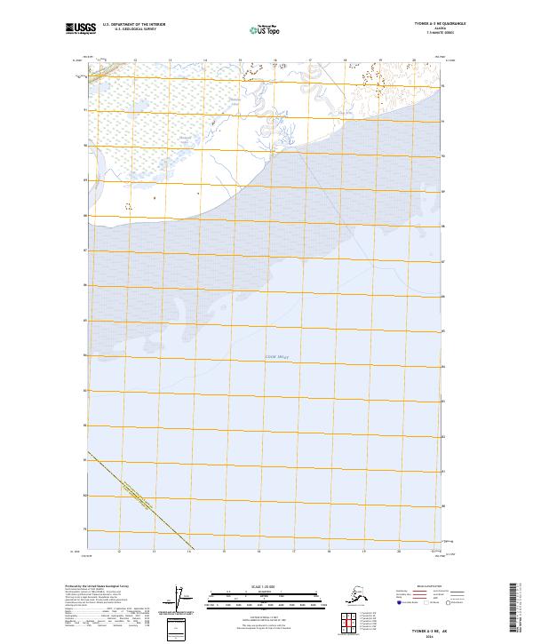
2024 Map of Tyonek A-3 NE
USGS Topo · Published 2024About this map
Cook Inlet dominates the central portion of this coastal landscape, where the waters of the North Pacific meet the southern edge of the Matanuska-Susitna Borough. The shoreline is a complex network of mudflats and river mouths, notably where the Theodore River and Lewis River discharge into the inlet. Further inland to the northwest, the Beluga Highway provides a rare corridor of terrestrial access through the marshy lowlands surrounding the Chedatna Lakes. The map also illustrates the convergence of political boundaries, showing the line where the Matanuska-Susitna Borough meets the Kenai Peninsula Borough across the open water. This drainage pattern, including the Beluga River to the west, indicates a dynamic estuarine environment defined by tidal influence and glacial runoff.
Find a feature on this map
9 named features on this map. Tap any name to fly to it.
Don’t see what you’re looking for? This feature index may not catch every label — zoom into the map to look around manually.
Map Details
Editions of this 2024 Tyonek A-3 NE Map
This is the sole edition of this map. No revisions or reprints were ever made.
Other maps of this area

1949 · Tyonek
USGS Topo · 1:250,000

1951 · Tyonek
USGS Topo · 1:250,000

1951 · Tyonek A-2
USGS Topo · 1:63,360

1952 · Tyonek A-2
USGS Topo · 1:63,360

1958 · Tyonek B-3
USGS Topo · 1:63,360
1958 · Tyonek A-3
USGS Topo · 1:63,360

1958 · Tyonek B-2
USGS Topo · 1:63,360

1958 · Tyonek
USGS Topo · 1:250,000

1965 · Tyonek
USGS Topo · 1:250,000
2013 · Tyonek B-3 SW
USGS Topo · 1:25,000