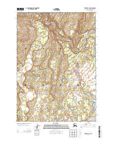
2013 Map of Tyonek A-4 NE
USGS Topo · Published 2013About this map
Beluga River dominates the northern reaches of this landscape on the Kenai Peninsula, carving a winding path through a network of smaller tributaries. The drainage patterns here are complex, defined by the convergence of Coffee Cr and the meandering flow of Threemile Cr. Further south, the terrain transitions into a more pond-heavy environment, anchored by the presence of Tukallah Lake. Smaller waterways like Lone Cr crisscross the lower sections, illustrating the intricate hydrology of this coastal borough. This map provides a clear record of the area's natural state in the early 21st century, showing a region where water and land are inextricably linked without the footprint of dense settlement or industrial development found in other parts of the peninsula.
Find a feature on this map
8 named features on this map. Tap any name to fly to it.
Don’t see what you’re looking for? This feature index may not catch every label — zoom into the map to look around manually.
Map Details
Editions of this 2013 Tyonek A-4 NE Map
This is the sole edition of this map. No revisions or reprints were ever made.
Other maps of this area

1949 · Tyonek
USGS Topo · 1:250,000

1951 · Tyonek
USGS Topo · 1:250,000

1954 · Tyonek B-4
USGS Topo · 1:63,360

1958 · Tyonek B-3
USGS Topo · 1:63,360

1958 · Tyonek A-4
USGS Topo · 1:63,360
1958 · Tyonek A-3
USGS Topo · 1:63,360

1958 · Tyonek
USGS Topo · 1:250,000

1965 · Tyonek
USGS Topo · 1:250,000
2013 · Tyonek A-4 NW
USGS Topo · 1:25,000
2013 · Tyonek B-3 SW
USGS Topo · 1:25,000