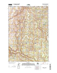
2013 Map of Tyonek A-4 NW
USGS Topo · Published 2013About this map
Lone Ridge dominates the northwestern portion of this Alaskan landscape within the Kenai Peninsula Borough, overlooking a complex drainage system that defines the local geography. The central and southern areas are characterized by the winding path of the Chuitna River, which is fed by numerous smaller tributaries including Scarp Cr and Lone Cr. To the south, the confluence of Tyonek Cr and Old Tyonek Cr marks a significant hydrological junction in the terrain. This 2013 survey illustrates the wilderness prior to extensive modern development, showing Denslow Lake tucked among the northern hills. The map provides a precise look at the township and range survey lines (R 11 W through R 13 W) as they intersect with these natural watercourses, useful for understanding land divisions in this part of the Kenai Peninsula.
Find a feature on this map
47 named features on this map. Tap any name to fly to it.
Don’t see what you’re looking for? This feature index may not catch every label — zoom into the map to look around manually.
Map Details
Editions of this 2013 Tyonek A-4 NW Map
This is the sole edition of this map. No revisions or reprints were ever made.
Other maps of this area

1949 · Tyonek
USGS Topo · 1:250,000

1951 · Tyonek
USGS Topo · 1:250,000

1954 · Tyonek B-4
USGS Topo · 1:63,360

1958 · Tyonek A-5
USGS Topo · 1:63,360

1958 · Tyonek A-4
USGS Topo · 1:63,360

1958 · Tyonek B-5
USGS Topo · 1:63,360

1958 · Tyonek
USGS Topo · 1:250,000

1965 · Tyonek
USGS Topo · 1:250,000
2013 · Tyonek B-5 SE
USGS Topo · 1:25,000
2013 · Tyonek A-5 NE
USGS Topo · 1:25,000