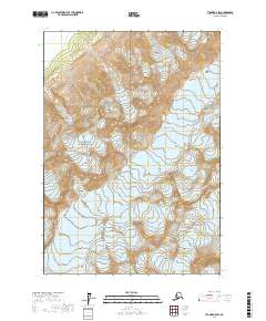
2017 Map of Tyonek A-8 SW
USGS Topo · Published 2017About this map
The Aleutian Range dominates this landscape on the Kenai Peninsula, where high-altitude ice and glacial runoff shape the terrain. A significant portion of this area is protected within Lake Clark National Park, preserving a wilderness defined by its dramatic elevation changes and geological activity. Two major ice bodies, Shamrock Glacier and Tanaina Glacier, are visible in the eastern half of the quadrangle, illustrating the persistent glaciated state of this subarctic region in the early 21st century. The Neacola River flows through the northwestern corner, representing the drainage systems that feed from these mountain ranges into the larger Alaskan watershed. This survey captures a moment in the modern environmental record, showing the exact extent of glacial coverage before seasonal shifts and long-term climatic patterns further alter these massive ice fields.
Find a feature on this map
9 named features on this map. Tap any name to fly to it.
Don’t see what you’re looking for? This feature index may not catch every label — zoom into the map to look around manually.
Map Details
Editions of this 2017 Tyonek A-8 SW Map
This is the sole edition of this map. No revisions or reprints were ever made.
Other maps of this area

1944 · Kenai
USGS Topo · 1:250,000

1946 · Lake Clark
USGS Topo · 1:250,000

1949 · Tyonek
USGS Topo · 1:250,000

1950 · Kenai
USGS Topo · 1:250,000

1951 · Lake Clark
USGS Topo · 1:250,000

1951 · Tyonek
USGS Topo · 1:250,000

1951 · Lime Hills
USGS Topo · 1:250,000

1958 · Kenai D-8
USGS Topo · 1:63,360

1958 · Tyonek
USGS Topo · 1:250,000

1958 · Tyonek A-8
USGS Topo · 1:63,360