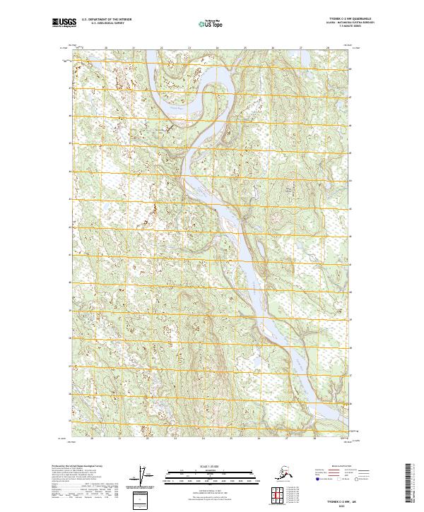
2023 Map of Tyonek C-2 NW
USGS Topo · Published 2023About this map
The Yentna River dominates this interior Alaskan landscape, carving a wide path through the lowlands of the Matanuska-Susitna Borough. In this remote riverine environment, transportation is defined by water and air rather than roads, as evidenced by the Yentna Bend Strip and Jewell Airport which serve as critical access points for this wilderness area. The serpentine path of Alexander Creek winds through the southwestern portion of the map, illustrating the complex drainage patterns of the region's wetlands and forests. Elevated terrain features such as Trail Ridge and Sdak'dal'iy provide topographic contrast to the surrounding river flats, serving as important landmarks for navigation in a territory where the natural environment remains largely undeveloped.
Find a feature on this map
10 named features on this map. Tap any name to fly to it.
Don’t see what you’re looking for? This feature index may not catch every label — zoom into the map to look around manually.
Map Details
Editions of this 2023 Tyonek C-2 NW Map
This is the sole edition of this map. No revisions or reprints were ever made.
Other maps of this area

1949 · Tyonek
USGS Topo · 1:250,000

1951 · Tyonek
USGS Topo · 1:250,000

1954 · Tyonek D-2
USGS Topo · 1:63,360

1954 · Tyonek D-3
USGS Topo · 1:63,360

1954 · Tyonek C-3
USGS Topo · 1:63,360

1958 · Tyonek C-2
USGS Topo · 1:63,360

1958 · Tyonek
USGS Topo · 1:250,000

1965 · Tyonek
USGS Topo · 1:250,000
1993 · Tyonek D-3
USGS Topo · 1:63,360
1993 · Tyonek D-2
USGS Topo · 1:63,360