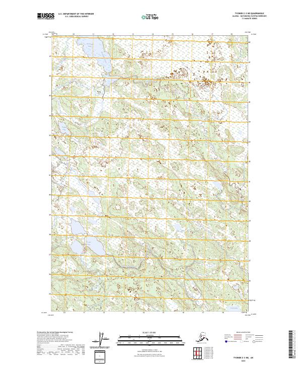
2023 Map of Tyonek C-3 NE
USGS Topo · Published 2023About this map
Alexander Lake and the meandering headwaters of Alexander Creek dominate this landscape within the Matanuska-Susitna Borough. The terrain is defined by an intricate network of wetlands and small water bodies, including Rabbit Lake to the west and the centralized Jean Lake. This 2023 survey illustrates a wilderness nearly devoid of human infrastructure, where the natural drainage patterns of Clear Creek, Bear Creek, and Tom Creek dictate the layout of the land. Further south, the map tracks the connectivity between Sucker Lake and the winding paths of Upper Sucker Creek and Lower Sucker Creek, concluding near the shores of Trail Lake. The absence of roads or established settlements emphasizes the remote, aquatic nature of this Alaskian interior region during the early 21st century.
Find a feature on this map
15 named features on this map. Tap any name to fly to it.
Don’t see what you’re looking for? This feature index may not catch every label — zoom into the map to look around manually.
Map Details
Editions of this 2023 Tyonek C-3 NE Map
This is the sole edition of this map. No revisions or reprints were ever made.
Other maps of this area

1949 · Tyonek
USGS Topo · 1:250,000

1951 · Tyonek
USGS Topo · 1:250,000

1954 · Tyonek D-2
USGS Topo · 1:63,360

1954 · Tyonek D-3
USGS Topo · 1:63,360

1954 · Tyonek C-3
USGS Topo · 1:63,360

1958 · Tyonek C-2
USGS Topo · 1:63,360

1958 · Tyonek
USGS Topo · 1:250,000

1965 · Tyonek
USGS Topo · 1:250,000
1993 · Tyonek D-3
USGS Topo · 1:63,360
1993 · Tyonek D-2
USGS Topo · 1:63,360