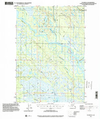
1993 Map of Tyonek D-3
USGS Topo · Published 2001About this map
The Yentna River and Kahiltna River converge in this remote landscape of the Matanuska-Susitna Borough, defined by a complex web of glacial waterways and marshy lowlands. The settlement of McDougal sits at a critical junction near where Indian Creek meets the main river channel, representing a focal point for early twentieth-century regional travel. The terrain is crisscrossed by historic seasonal routes, most notably the Iditarod Trail (Approximate) and various segments of the Winter Trail, which provided essential overland access before modern infrastructure. Numerous water bodies such as Fish Lakes, Bulchitna Lake, and Alexander Lake dot the map, alongside scattered cabins and a landing strip that highlight the reliance on bush aviation and small-scale habitation in the Alaskan interior. The presence of Twentymile Slough and multiple named creeks like Deep Creek and Fox Creek further illustrate the intricate drainage patterns of this subarctic environment.
Find a feature on this map
21 named features on this map. Tap any name to fly to it.
Don’t see what you’re looking for? This feature index may not catch every label — zoom into the map to look around manually.
Map Details
Editions of this 1993 Tyonek D-3 Map
This is the sole edition of this map. No revisions or reprints were ever made.
Other maps of this area

1949 · Tyonek
USGS Topo · 1:250,000

1950 · Talkeetna
USGS Topo · 1:250,000

1951 · Talkeetna
USGS Topo · 1:250,000

1951 · Tyonek
USGS Topo · 1:250,000

1954 · Tyonek D-2
USGS Topo · 1:63,360

1954 · Tyonek D-3
USGS Topo · 1:63,360

1954 · Talkeetna A-3
USGS Topo · 1:63,360

1954 · Tyonek C-4
USGS Topo · 1:63,360

1954 · Tyonek D-4
USGS Topo · 1:63,360

1954 · Talkeetna A-2
USGS Topo · 1:63,360