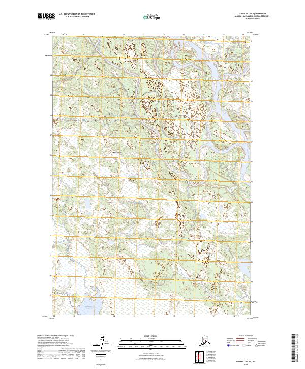
2023 Map of Tyonek D-3 SE
USGS Topo · Published 2023About this map
Skwentna sits within an intricate network of waterways where the Yentna River and Kahiltna River converge, defining the geography of this Matanuska-Susitna region. This modern topographic survey illustrates a landscape dominated by riverine dynamics, featuring Twentymile Slough and the winding course of Indian Creek. The hydrology of the area is further characterized by Kutna Creek and the presence of Alexander Lake to the south. The mapping of township and range lines, such as t20n r9w, provides a structural framework for understanding land distribution in this part of Alaska. This document reflects the contemporary state of the river systems and the isolated settlement patterns typical of the region's bush communities.
Find a feature on this map
13 named features on this map. Tap any name to fly to it.
Don’t see what you’re looking for? This feature index may not catch every label — zoom into the map to look around manually.
Map Details
Editions of this 2023 Tyonek D-3 SE Map
This is the sole edition of this map. No revisions or reprints were ever made.
Other maps of this area

1949 · Tyonek
USGS Topo · 1:250,000

1951 · Tyonek
USGS Topo · 1:250,000

1954 · Tyonek D-2
USGS Topo · 1:63,360

1954 · Tyonek D-3
USGS Topo · 1:63,360

1954 · Tyonek C-3
USGS Topo · 1:63,360

1958 · Tyonek C-2
USGS Topo · 1:63,360

1958 · Tyonek
USGS Topo · 1:250,000

1965 · Tyonek
USGS Topo · 1:250,000
1993 · Tyonek D-3
USGS Topo · 1:63,360
1993 · Tyonek D-2
USGS Topo · 1:63,360