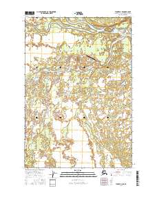
2016 Map of Tyonek D-4 NE
USGS Topo · Published 2016About this map
The confluence of the Skwentna River and the braided channels of the Yentna River dominates this remote Alaskan landscape. This 2016 survey highlights the isolated settlement of Skwentna, a critical junction where aviation and river transport meet. The terrain is defined by a complex network of wetlands and seasonal waterways, including Eightmile Cr and Hewitt Creek, which snake through the lowland basin. Human infrastructure is concentrated near the riverbanks, notably the Skwentna Airport and its connection via the Skwentna Airport Access Road and Range Road. This map provides a detailed view of the region's hydraulic character, where the shifting bars of the larger rivers dictate the geography of the surrounding wilderness.
Find a feature on this map
13 named features on this map. Tap any name to fly to it.
Don’t see what you’re looking for? This feature index may not catch every label — zoom into the map to look around manually.
Map Details
Editions of this 2016 Tyonek D-4 NE Map
This is the sole edition of this map. No revisions or reprints were ever made.
Other maps of this area

1949 · Tyonek
USGS Topo · 1:250,000

1950 · Talkeetna
USGS Topo · 1:250,000

1951 · Talkeetna
USGS Topo · 1:250,000

1951 · Tyonek
USGS Topo · 1:250,000

1954 · Tyonek D-3
USGS Topo · 1:63,360

1954 · Talkeetna A-3
USGS Topo · 1:63,360

1954 · Tyonek D-4
USGS Topo · 1:63,360

1958 · Tyonek
USGS Topo · 1:250,000

1958 · Talkeetna
USGS Topo · 1:250,000

1965 · Tyonek
USGS Topo · 1:250,000