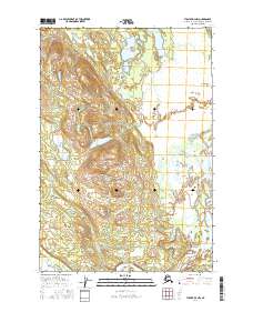
2016 Map of Tyonek D-4 NW
USGS Topo · Published 2016About this map
The Skwentna River winds through the southern reaches of this landscape, forming a complex drainage system within the Matanuska-Susitna Borough. This region is defined by its extensive wetland and alluvial patterns, where water bodies like Hewitt Cr and the Nustatuxna Nichila Bultnu thread through the lowlands. The topographic character is marked by the Shell Hills, which rise above the surrounding basin, and the broad, level expanse of Snag Flats. Notable landforms such as Bourbon Mist Island and the specifically named Kentuhdilk'et Kena highlight the unique geographical naming conventions of the area. This survey provides a precise look at the hydrology and terrain of the Tyonek quadrangle before modern development altered these remote Alaskan wetlands.
Find a feature on this map
11 named features on this map. Tap any name to fly to it.
Don’t see what you’re looking for? This feature index may not catch every label — zoom into the map to look around manually.
Map Details
Editions of this 2016 Tyonek D-4 NW Map
This is the sole edition of this map. No revisions or reprints were ever made.
Other maps of this area

1949 · Tyonek
USGS Topo · 1:250,000

1950 · Talkeetna
USGS Topo · 1:250,000

1951 · Talkeetna
USGS Topo · 1:250,000

1951 · Tyonek
USGS Topo · 1:250,000

1954 · Talkeetna A-3
USGS Topo · 1:63,360

1954 · Tyonek D-5
USGS Topo · 1:63,360

1954 · Tyonek D-4
USGS Topo · 1:63,360

1954 · Talkeetna A-4
USGS Topo · 1:63,360

1958 · Tyonek
USGS Topo · 1:250,000

1958 · Talkeetna
USGS Topo · 1:250,000