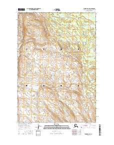
2016 Map of Tyonek D-5 SE
USGS Topo · Published 2016About this map
Canyon Cr flows across the northern reaches of this interior Alaskan landscape, which remains largely defined by its intricate drainage patterns and glacial landforms. The terrain is structured by a series of south-flowing waterways, including Quartz Cr and Thursday Cr, which carve through the undulating topography within the boundaries of the Matanuska-Susitna Borough. Towards the southern edge of the sheet, Deep Cr further illustrates the complex hydrological network of the Susitna Valley. The map documents the vast, undeveloped character of this region as of 2016, where surveyors have recorded the natural contours and water systems that dictate the movement of water from the high ground toward the coastal basins. This survey serves as a modern baseline for understanding the physical geography of the t20n r13w and t20n r12w townships.
Find a feature on this map
10 named features on this map. Tap any name to fly to it.
Don’t see what you’re looking for? This feature index may not catch every label — zoom into the map to look around manually.
Map Details
Editions of this 2016 Tyonek D-5 SE Map
This is the sole edition of this map. No revisions or reprints were ever made.
Other maps of this area

1949 · Tyonek
USGS Topo · 1:250,000

1951 · Tyonek
USGS Topo · 1:250,000

1954 · Tyonek C-5
USGS Topo · 1:63,360

1954 · Tyonek C-4
USGS Topo · 1:63,360

1954 · Tyonek D-5
USGS Topo · 1:63,360

1954 · Tyonek D-4
USGS Topo · 1:63,360

1958 · Tyonek
USGS Topo · 1:250,000

1965 · Tyonek
USGS Topo · 1:250,000
1993 · Tyonek D-4
USGS Topo · 1:63,360
2016 · Tyonek C-4 NW
USGS Topo · 1:25,000