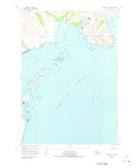
1951 Map of Ugashik B-1
USGS Topo · Published 1975About this map
Shelikof Strait dominates this coastal survey, where the rugged shoreline of the Alaska Peninsula meets the North Pacific waters. This area, largely untouched by infrastructure in the early 1950s, is defined by significant maritime landmarks like Cape Igvak and Cape Kayakliut. The presence of Lee Cabin near the mouth of Des Moines Creek suggests a solitary point of human habitation or seasonal activity in an otherwise unpopulated landscape. The cartography reveals a complex marine environment featuring Wide Bay and Portage Bay, separated by high ridges and peaks such as VABM 1923 Alpokk. Notable coastal features like Coal Point and several islands, including Terrace Island and Hartman Island, provide critical reference points for navigation through the West Channel and East Channel.
Find a feature on this map
19 named features on this map. Tap any name to fly to it.
Don’t see what you’re looking for? This feature index may not catch every label — zoom into the map to look around manually.
Map Details
Editions of this 1951 Ugashik B-1 Map
3 editions found
Other maps of this area

1943 · Ugashik
USGS Topo · 1:250,000

1948 · Ugashik
USGS Topo · 1:250,000

1949 · Ugashik
USGS Topo · 1:250,000

1951 · Karluk
USGS Topo · 1:250,000

1951 · Ugashik B-1
USGS Topo · 1:63,360

1951 · Ugashik C-1
USGS Topo · 1:63,360

1951 · Ugashik C-2
USGS Topo · 1:63,360
1951 · Karluk C-6
USGS Topo · 1:63,360

1951 · Ugashik A-2
USGS Topo · 1:63,360

1951 · Ugashik B-2
USGS Topo · 1:63,360