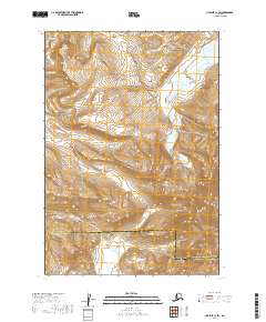
2019 Map of Ugashik C-1 SW
USGS Topo · Published 2019About this map
Mt Ugashik dominates the northwestern terrain of this 2019 survey, where the peaks of the Aleutian Range meet the hydrologic networks of the Alaska Peninsula. The landscape is defined by the headwaters of several drainages, including McNally Cr and Ugashik Cr, which flow through deep glacial valleys. In the northeast corner, a portion of Becharof Lake is visible, representing one of the most significant water bodies in the region. This map also documents the administrative boundary between the Lake and Peninsula Borough and the Kodiak Island Borough, illustrating how modern jurisdictional lines are drawn across this remote wilderness. The interplay of high-elevation ridges and lower basins like those of Big Cr and Crooked Cr highlights the complex topography of this subarctic environment.
Find a feature on this map
11 named features on this map. Tap any name to fly to it.
Don’t see what you’re looking for? This feature index may not catch every label — zoom into the map to look around manually.
Map Details
Editions of this 2019 Ugashik C-1 SW Map
This is the sole edition of this map. No revisions or reprints were ever made.
Other maps of this area

1943 · Ugashik
USGS Topo · 1:250,000

1948 · Ugashik
USGS Topo · 1:250,000

1949 · Ugashik
USGS Topo · 1:250,000

1951 · Ugashik B-1
USGS Topo · 1:63,360

1951 · Ugashik C-1
USGS Topo · 1:63,360

1951 · Ugashik C-2
USGS Topo · 1:63,360

1951 · Ugashik B-2
USGS Topo · 1:63,360

1963 · Ugashik
USGS Topo · 1:250,000
2019 · Ugashik C-2 SE
USGS Topo · 1:25,000
2019 · Ugashik C-1 NE
USGS Topo · 1:25,000