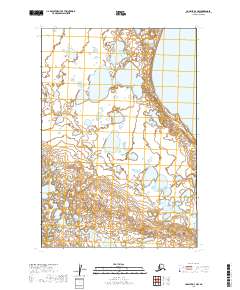
2019 Map of Ugashik D-3 NW
USGS Topo · Published 2019About this map
Becharof Lake defines the northeastern corner of this coastal Alaskan landscape, situated within the Lake and Peninsula Borough. The terrain is marked by an intricate network of wetlands and small glacial ponds that populate the lowlands between higher ground. This map provides a detailed look at the Public Land Survey System (PLSS) grid, documenting sections within townships t25s r47w, t25s r46w, t26s r47w, t26s r46w, t27s r47w, and t27s r46w. The lack of named settlements or roads underscores the wilderness character of the Alaska Peninsula during this contemporary survey period, where the hydrography and topographic contours remain the primary points of orientation for navigation and land management.
Find a feature on this map
7 named features on this map. Tap any name to fly to it.
Don’t see what you’re looking for? This feature index may not catch every label — zoom into the map to look around manually.
Map Details
Editions of this 2019 Ugashik D-3 NW Map
This is the sole edition of this map. No revisions or reprints were ever made.
Other maps of this area

1943 · Ugashik
USGS Topo · 1:250,000

1948 · Ugashik
USGS Topo · 1:250,000

1949 · Ugashik
USGS Topo · 1:250,000

1951 · Ugashik D-3
USGS Topo · 1:63,360

1951 · Ugashik D-4
USGS Topo · 1:63,360

1951 · Naknek A-4
USGS Topo · 1:63,360

1951 · Naknek A-3
USGS Topo · 1:63,360

1952 · Naknek
USGS Topo · 1:250,000

1963 · Ugashik
USGS Topo · 1:250,000

1964 · Naknek
USGS Topo · 1:250,000