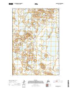
2019 Map of Ugashik D-5 NE
USGS Topo · Published 2019About this map
Glacial landforms and a high density of small water bodies characterize this landscape in the Lake and Peninsula Borough. The terrain is organized by the Public Land Survey System, with the map covering portions of T25s R50w, T25s R49w, T26s R50w, and T26s R49w. This 2019 survey documents a region defined by its hydrography, showing hundreds of unnamed ponds and wetlands that suggest a post-glacial environment where drainage is still developing.
Find a feature on this map
6 named features on this map. Tap any name to fly to it.
Don’t see what you’re looking for? This feature index may not catch every label — zoom into the map to look around manually.
Map Details
Editions of this 2019 Ugashik D-5 NE Map
This is the sole edition of this map. No revisions or reprints were ever made.
Other maps of this area

1943 · Ugashik
USGS Topo · 1:250,000

1948 · Ugashik
USGS Topo · 1:250,000

1949 · Ugashik
USGS Topo · 1:250,000

1951 · Ugashik D-5 and D-6
USGS Topo · 1:63,360

1951 · Ugashik D-4
USGS Topo · 1:63,360

1951 · Naknek A-5
USGS Topo · 1:63,360

1951 · Naknek A-4
USGS Topo · 1:63,360

1952 · Naknek
USGS Topo · 1:250,000

1963 · Ugashik
USGS Topo · 1:250,000

1964 · Naknek
USGS Topo · 1:250,000