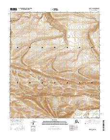
2016 Map of Umiat B-4 NW
USGS Topo · Published 2016About this map
The Arctic landscape of the North Slope is defined by its complex drainage patterns and shifting hydrology in this 2016 survey. Seabee Cr and Bearpaw Cr wind through the southern sections of the quadrangle, eventually converging near Umiat Lake in the southeast corner. To the north, the Br of Kogosukruk River cuts through the high tundra, illustrating the intricate network of streams that dictate the character of this subarctic terrain. The map is primarily an environmental record, documenting a region where water and permafrost shape the land without the intervention of permanent settlements or roads. The sparse presence of Robert Cr and other named water bodies highlights how these seasonal and permanent waterways serve as the primary landmarks in an otherwise open wilderness.
Find a feature on this map
11 named features on this map. Tap any name to fly to it.
Don’t see what you’re looking for? This feature index may not catch every label — zoom into the map to look around manually.
Map Details
Editions of this 2016 Umiat B-4 NW Map
This is the sole edition of this map. No revisions or reprints were ever made.
Other maps of this area

1952 · Umiat
USGS Topo · 1:250,000

1955 · Umiat B-4
USGS Topo · 1:63,360

1955 · Umiat C-4
USGS Topo · 1:63,360

1955 · Umiat C-5
USGS Topo · 1:63,360

1955 · Umiat B-5
USGS Topo · 1:63,360

1956 · Umiat
USGS Topo · 1:250,000

1964 · Umiat
USGS Topo · 1:250,000
2013 · Umiat C-4 SE
USGS Topo · 1:25,000
2013 · Umiat C-4 SW
USGS Topo · 1:25,000
2015 · Umiat C-5 SE
USGS Topo · 1:25,000