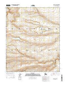
2015 Map of Umiat C-5 SE
USGS Topo · Published 2015About this map
Kogosukruk River snakes through this North Slope landscape, carving a subtle valley through the high Arctic tundra. This 2015 U.S. Geological Survey representation documents the hydrography and elevation of the region at a high degree of precision, showing the river as it flows between the townships of t3n r3w, t3n r2w, t2n r3w, and t2n r2w. The terrain is characterized by intricate contour lines that reveal the gentle slopes and drainage patterns of the Alaskan wilderness, where small, unnamed lakes and ephemeral streams dot the plateau. Because the map includes the Public Land Survey System grid, it allows for specific identification of topographic changes within these designated sections of the North Slope Borough.
Find a feature on this map
5 named features on this map. Tap any name to fly to it.
Don’t see what you’re looking for? This feature index may not catch every label — zoom into the map to look around manually.
Map Details
Editions of this 2015 Umiat C-5 SE Map
This is the sole edition of this map. No revisions or reprints were ever made.
Other maps of this area

1952 · Umiat
USGS Topo · 1:250,000

1955 · Umiat B-4
USGS Topo · 1:63,360

1955 · Umiat C-4
USGS Topo · 1:63,360

1955 · Umiat C-5
USGS Topo · 1:63,360

1955 · Umiat B-5
USGS Topo · 1:63,360

1956 · Umiat
USGS Topo · 1:250,000

1964 · Umiat
USGS Topo · 1:250,000
2013 · Umiat C-4 NW
USGS Topo · 1:25,000
2013 · Umiat C-4 SW
USGS Topo · 1:25,000
2015 · Umiat C-5 NE
USGS Topo · 1:25,000