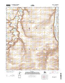
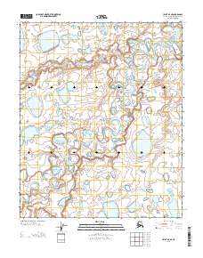
2013 Map of Umiat C-3 NW
USGS Topo · Published 2013About this map
The Colville River carves a massive course along the eastern edge of this Arctic landscape, defining the hydrologic character of the North Slope. Meandering tributaries such as the Kogosukruk River and Ingaluat Cr thread through the tundra, revealing the intricate drainage patterns of this permafrost-underlain region. The lack of built infrastructure or settlements highlights the isolation of this Arctic environment, where the land is primarily characterized by subtle topographic shifts and the seasonal flow of its river systems. Researchers can observe the complex braided channels and oxbow formations where Kikak Cr approaches the primary river valley, illustrating the geomorphology of a landscape largely untouched by permanent development.
Find a feature on this map
8 named features on this map. Tap any name to fly to it.
Don’t see what you’re looking for? This feature index may not catch every label — zoom into the map to look around manually.
Map Details
Editions of this 2013 Umiat C-3 NW Map
This is the sole edition of this map. No revisions or reprints were ever made.
Other maps of this area

1952 · Umiat
USGS Topo · 1:250,000

1955 · Umiat C-4
USGS Topo · 1:63,360

1955 · Umiat D-3
USGS Topo · 1:63,360
1955 · Umiat D-4
USGS Topo · 1:63,360

1955 · Umiat C-3
USGS Topo · 1:63,360

1956 · Umiat
USGS Topo · 1:250,000

1964 · Umiat
USGS Topo · 1:250,000
2013 · Umiat C-4 SE
USGS Topo · 1:25,000
2013 · Umiat D-3 SW
USGS Topo · 1:25,000
2013 · Umiat D-4 SE
USGS Topo · 1:25,000