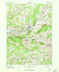
1943 Map of Unadilla
USGS Topo · Published 1972About this map
The Susquehanna River valley serves as a primary corridor through this portion of Delaware County, where the village of Unadilla is established at the junction of Martin Brook. This 1943 survey, conducted during the war years, captures the region's heavy reliance on rail transport, featuring the dual paths of the Hudson and Delaware and the New York Ontario and Western railroads. These lines parallel the river and wind through the hills toward Sidney Center, which was also known as Maywood Station.
Find a feature on this map
36 named features on this map. Tap any name to fly to it.
Don’t see what you’re looking for? This feature index may not catch every label — zoom into the map to look around manually.
Map Details
Editions of this 1943 Unadilla Map
4 editions found
Other maps of this area

1915 · Oneonta
USGS Topo · 1:62,500

1915 · Unadilla
USGS Topo · 1:62,500

1918 · Unadilla
USGS Topo · 1:62,500

1918 · Oneonta
USGS Topo · 1:62,500

1923 · Walton
USGS Topo · 1:48,000

1924 · Deposit
USGS Topo · 1:62,500

1925 · Walton
USGS Topo · 1:62,500

1926 · Deposit
USGS Topo · 1:62,500

1943 · Sidney
USGS Topo · 1:24,000

1943 · Gilbertsville
USGS Topo · 1:24,000