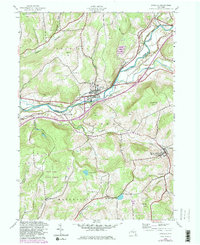
1943 Map of Unadilla
USGS Topo · Published 1983About this map
The Susquehanna River valley serves as the primary artery for settlement and transport through this section of Delaware and Otsego Counties. The village of Unadilla is the principal hub, situated where the Hudson and Delaware Railroad follows the northern riverbank. This mid-century landscape reflects a balance of riverside commerce and upland agriculture, with many valley-bottom homesteads and smaller outlying communities like South Unadilla and Youngs.
Find a feature on this map
42 named features on this map. Tap any name to fly to it.
Don’t see what you’re looking for? This feature index may not catch every label — zoom into the map to look around manually.
Map Details
Editions of this 1943 Unadilla Map
4 editions found
Other maps of this area

1915 · Oneonta
USGS Topo · 1:62,500

1915 · Unadilla
USGS Topo · 1:62,500

1918 · Unadilla
USGS Topo · 1:62,500

1918 · Oneonta
USGS Topo · 1:62,500

1923 · Walton
USGS Topo · 1:48,000

1924 · Deposit
USGS Topo · 1:62,500

1925 · Walton
USGS Topo · 1:62,500

1926 · Deposit
USGS Topo · 1:62,500

1943 · Sidney
USGS Topo · 1:24,000

1943 · Gilbertsville
USGS Topo · 1:24,000