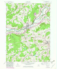
1943 Map of Unadilla
USGS Topo · Published 1983About this map
The Susquehanna River flows through this 1943 survey, serving as the boundary between the villages of Unadilla and South Unadilla. The transport corridor is defined by the Hudson and Delaware Railroad, which follows the riverbank, and a prominent Old Railroad Grade that traces the valley south of Poplar Hill. This era shows a landscape transitioning between agricultural roots and state-managed conservation, evidenced by the established Pine Hill State Forest.
Find a feature on this map
43 named features on this map. Tap any name to fly to it.
Don’t see what you’re looking for? This feature index may not catch every label — zoom into the map to look around manually.
Map Details
Editions of this 1943 Unadilla Map
4 editions found
Other maps of this area

1915 · Oneonta
USGS Topo · 1:62,500

1915 · Unadilla
USGS Topo · 1:62,500

1918 · Unadilla
USGS Topo · 1:62,500

1918 · Oneonta
USGS Topo · 1:62,500

1923 · Walton
USGS Topo · 1:48,000

1924 · Deposit
USGS Topo · 1:62,500

1925 · Walton
USGS Topo · 1:62,500

1926 · Deposit
USGS Topo · 1:62,500

1943 · Sidney
USGS Topo · 1:24,000

1943 · Gilbertsville
USGS Topo · 1:24,000