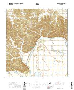
2017 Map of Unalakleet A-1 SE
USGS Topo · Published 2017About this map
Innoko National Wildlife Refuge dominates the interior of this topographic study, encompassing a landscape defined by the serpentine path of the Innoko River. This region within the Yukon-Koyukuk Census Area is characterized by a complex network of wetlands and seasonal water bodies that flank the river’s main channel as it moves through t28s r3w and t28s r2w. The survey illustrates the subtle elevation changes of the surrounding terrain, where low-lying marshes give way to slightly higher ground marked by detailed contour intervals. As a remote portion of Alaska's interior, the map provides a precise record of the river's natural hydrology and the expansive boundaries of the federal conservation lands prior to further environmental shifts.
Find a feature on this map
8 named features on this map. Tap any name to fly to it.
Don’t see what you’re looking for? This feature index may not catch every label — zoom into the map to look around manually.
Map Details
Editions of this 2017 Unalakleet A-1 SE Map
This is the sole edition of this map. No revisions or reprints were ever made.
Other maps of this area

1951 · Ophir
USGS Topo · 1:250,000

1951 · Unalakleet
USGS Topo · 1:250,000

1951 · Holy Cross
USGS Topo · 1:250,000

1951 · Iditarod
USGS Topo · 1:250,000

1952 · Unalakleet A-1
USGS Topo · 1:63,360

1952 · Holy Cross D-1
USGS Topo · 1:63,360

1952 · Unalakleet
USGS Topo · 1:250,000

1952 · Holy Cross
USGS Topo · 1:250,000

1954 · Ophir A-6
USGS Topo · 1:63,360

1954 · Iditarod D-6
USGS Topo · 1:63,360