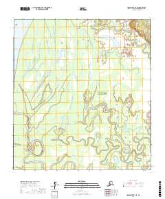
2017 Map of Unalakleet A-2 SE
USGS Topo · Published 2017About this map
The Yukon River flows through the northwestern corner of this territory, where it meets Polly Island in a landscape dominated by complex waterways. A significant portion of the land is protected as the Innoko National Wildlife Refuge, characterized by the meandering path of the Shageluk Slough. This slough creates an intricate network of oxbow lakes and wetlands that define the interior drainage patterns of the region. To the southeast, Sucker Creek winds through the wilderness, illustrating the saturated, low-lying character of the Yukon-Koyukuk interior. The map documents a primitive landscape where natural watercourses are the primary geographical markers, largely untouched by permanent road infrastructure or industrial development.
Find a feature on this map
14 named features on this map. Tap any name to fly to it.
Don’t see what you’re looking for? This feature index may not catch every label — zoom into the map to look around manually.
Map Details
Editions of this 2017 Unalakleet A-2 SE Map
This is the sole edition of this map. No revisions or reprints were ever made.
Other maps of this area

1951 · Unalakleet
USGS Topo · 1:250,000

1951 · Holy Cross
USGS Topo · 1:250,000

1952 · Unalakleet A-2
USGS Topo · 1:63,360

1952 · Unalakleet A-1
USGS Topo · 1:63,360

1952 · Holy Cross D-2
USGS Topo · 1:63,360

1952 · Holy Cross D-1
USGS Topo · 1:63,360

1952 · Unalakleet
USGS Topo · 1:250,000

1952 · Holy Cross
USGS Topo · 1:250,000

1964 · Unalakleet
USGS Topo · 1:250,000
2015 · Unalakleet A-2 NW
USGS Topo · 1:25,000