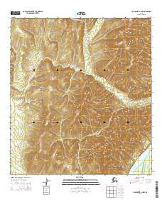
2015 Map of Unalakleet A-2 NW
USGS Topo · Published 2015About this map
The Kaiyuh Mountains dominate the interior of this Alaskan landscape, defining a terrain of steep ridges and high drainage basins. Flowing from these heights, Simon Cr winds through the northern portion of the quadrangle before eventually reaching the lower elevations near the massive Yukon River corridor. The river itself makes a brief appearance in the southeastern corner, signifying the critical importance of this water artery to the regional geography of the Yukon-Koyukuk area. The map illustrates a remote wilderness where the natural topography dictates the movement of water and the layout of the Public Land Survey System, as evidenced by the boundaries of t26s r6w and t27s r7w.
Find a feature on this map
7 named features on this map. Tap any name to fly to it.
Don’t see what you’re looking for? This feature index may not catch every label — zoom into the map to look around manually.
Map Details
Editions of this 2015 Unalakleet A-2 NW Map
This is the sole edition of this map. No revisions or reprints were ever made.
Other maps of this area

1951 · Unalakleet
USGS Topo · 1:250,000

1952 · Unalakleet A-2
USGS Topo · 1:63,360

1952 · Unalakleet A-3
USGS Topo · 1:63,360

1952 · Unalakleet B-3
USGS Topo · 1:63,360

1952 · Unalakleet B-2
USGS Topo · 1:63,360

1952 · Unalakleet
USGS Topo · 1:250,000

1964 · Unalakleet
USGS Topo · 1:250,000
2015 · Unalakleet B-2 SE
USGS Topo · 1:25,000
2015 · Unalakleet B-2 SW
USGS Topo · 1:25,000
2015 · Unalakleet A-3 NE
USGS Topo · 1:25,000