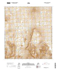
2017 Map of Unalakleet A-6 NE
USGS Topo · Published 2017About this map
Iprugalet Mtn stands as a prominent landmark in this interior Alaskan landscape, which is defined by its dramatic elevation changes and intricate hydrography. The terrain is shaped by the presence of the Andreafsky River and the E Fork Andreafsky River, which carve through the region. This 2017 survey by the U.S. Geological Survey illustrates the transition between the high ridges and the marshy, lake-dotted lowlands. The dense concentration of small water bodies and seasonal wetlands in the northern sections suggests a complex drainage pattern typical of the Nome Census Area. For researchers, this map provides a precise contemporary record of the natural boundaries and topographic features of the Unalakleet region, documenting the land as it exists in the early twenty-first century.
Find a feature on this map
7 named features on this map. Tap any name to fly to it.
Don’t see what you’re looking for? This feature index may not catch every label — zoom into the map to look around manually.
Map Details
Editions of this 2017 Unalakleet A-6 NE Map
This is the sole edition of this map. No revisions or reprints were ever made.
Other maps of this area

1951 · Unalakleet
USGS Topo · 1:250,000

1952 · Unalakleet A-5
USGS Topo · 1:63,360

1952 · Unalakleet B-6
USGS Topo · 1:63,360

1952 · Unalakleet B-5
USGS Topo · 1:63,360

1952 · Unalakleet A-6
USGS Topo · 1:63,360

1952 · Unalakleet
USGS Topo · 1:250,000

1964 · Unalakleet
USGS Topo · 1:250,000
2017 · Unalakleet A-6 SW
USGS Topo · 1:25,000
2017 · Unalakleet B-6 SE
USGS Topo · 1:25,000
2017 · Unalakleet B-6 SW
USGS Topo · 1:25,000