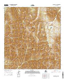
2015 Map of Unalakleet B-3 SW
USGS Topo · Published 2015About this map
The Nulato Hills dominate this portion of the Alaskan interior, characterized by a series of prominent peaks and high-elevation drainages. Central to the topography is Bear Mtn, rising significantly over the surrounding landscape and providing a primary point of orientation in the northern section of the survey. To the southwest, Mt McDonald serves as another major elevation marker, illustrating the corrugated relief of the region. The map tracks the headwaters and winding course of Canyon Cr, which cuts through the mountainous terrain. This 2015 update, produced by the Alaska Dept. of Transportation in cooperation with federal agencies, captures the area’s hydrography and public land divisions including t25s r9w and surrounding townships, providing a clear picture of the remote interior's physical geography.
Find a feature on this map
12 named features on this map. Tap any name to fly to it.
Don’t see what you’re looking for? This feature index may not catch every label — zoom into the map to look around manually.
Map Details
Editions of this 2015 Unalakleet B-3 SW Map
This is the sole edition of this map. No revisions or reprints were ever made.
Other maps of this area

1951 · Unalakleet
USGS Topo · 1:250,000

1952 · Unalakleet A-4
USGS Topo · 1:63,360

1952 · Unalakleet A-3
USGS Topo · 1:63,360

1952 · Unalakleet B-4
USGS Topo · 1:63,360

1952 · Unalakleet B-3
USGS Topo · 1:63,360

1952 · Unalakleet
USGS Topo · 1:250,000

1964 · Unalakleet
USGS Topo · 1:250,000
2015 · Unalakleet B-4 NE
USGS Topo · 1:25,000
2015 · Unalakleet B-3 NE
USGS Topo · 1:25,000
2015 · Unalakleet B-3 NW
USGS Topo · 1:25,000