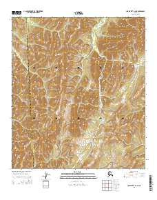
2015 Map of Unalakleet D-2 NE
USGS Topo · Published 2015About this map
Tenmile River defines the central drainage of this interior Alaskan landscape, winding through a complex system of ridges and valleys. The map documents a significant administrative boundary where the Yukon-Koyukuk Census Area meets the Nome Census Area, a line that cuts across the high terrain of the western interior. In the southern portion of the sheet, the small drainage of Bear Cr flows through the township of T19S R5W. The area is characterized by significant vertical relief, with contours showing the rise and fall of the Unalakleet highlands. This 2015 survey provides a modern snapshot of the Public Land Survey System grid across the townships of T17S, T18S, and T19S, illustrating the geometric subdivision of this sparsely settled wilderness.
Find a feature on this map
12 named features on this map. Tap any name to fly to it.
Don’t see what you’re looking for? This feature index may not catch every label — zoom into the map to look around manually.
Map Details
Editions of this 2015 Unalakleet D-2 NE Map
This is the sole edition of this map. No revisions or reprints were ever made.
Other maps of this area

1948 · Norton Bay
USGS Topo · 1:250,000

1951 · Unalakleet
USGS Topo · 1:250,000

1951 · Norton Bay
USGS Topo · 1:250,000

1952 · Unalakleet D-2
USGS Topo · 1:63,360

1952 · Unalakleet D-1
USGS Topo · 1:63,360

1952 · Unalakleet
USGS Topo · 1:250,000
1953 · Norton Bay A-2
USGS Topo · 1:63,360
1954 · Norton Bay A-1
USGS Topo · 1:63,360

1955 · Norton Bay
USGS Topo · 1:250,000

1964 · Unalakleet
USGS Topo · 1:250,000